Alpine Rhine flood defense initiative revitalizes natural habitats
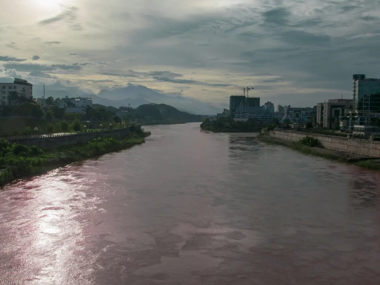
The Alpine Rhine, a river that stretches between Austria and Switzerland, is set for a significant transformation in the coming years. The "RHESI" project, a joint endeavour by representatives from the respective national water management and environmental agencies of both countries, aims to improve the ecology of the river and make it as natural as possible.
The project, which came into force on July 1, 2025, with the fourth state treaty with Switzerland, is scheduled to begin this decade. The construction period for RHESI is 20 years, and the costs amount to 2.1 billion euros.
The river, previously regulated as a straightened canal into Lake Constance, will be transformed into a braided river over the next few decades. The main channel will be widened with the removal of inner dams, and outer dams will be made more stable and dense. A widening section is planned before the mouth of Lake Constance.
Flood protection will always be the main goal of the RHESI project. The flood control structures along the Rhine, implemented in 1892, currently withstand a flow rate of 3,100 cubic meters per second, equivalent to a 100-year flood. By 2040, the dams from the Ill to the Lake Constance mouth will be expanded to handle 4,300 cubic meters per second, providing protection against a 300-year flood.
The RHESI project also aims to improve biodiversity in and around the Rhine. Currently, the Alpine Rhine has a "dissatisfactory" ecological status, with little biodiversity in and around the river and its floodplains. Biodiversity is expected to significantly improve ten years after the RHESI project, with the largest "core habitat" planned at the mouth of the Frutz into the Rhine, where the river will be allowed to widen up to 400 meters. Further core habitats are planned at Maeder-Kriessern (district of Feldkirch/Canton of St. Gallen) and Lustenau-Widnau (district of Dornbirn/Canton of St. Gallen).
These core habitats and widening sections can serve as stepping stones for species to colonize and migrate between the refuges. New areas for near-natural recreation with water access will be available elsewhere to ensure public enjoyment while protecting the core habitats via viewing platforms.
The Rhine will continue to be monitored closely for management purposes, including the formation of the Auwald and the extraction of up to 90,000 cubic meters of gravel and sand. The riparian forest, however, is expected to take several decades longer to improve.
Despite the vast changes, the RHESI project remains committed to maintaining flood protection while creating a more natural and biodiverse river system for future generations to enjoy.
Read also:
- Peptide YY (PYY): Exploring its Role in Appetite Suppression, Intestinal Health, and Cognitive Links
- Toddler Health: Rotavirus Signs, Origins, and Potential Complications
- Digestive issues and heart discomfort: Root causes and associated health conditions
- House Infernos: Deadly Hazards Surpassing the Flames


